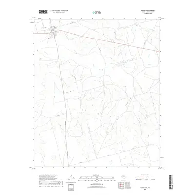
2019 Map of Garden City
USGS Topo · Published 2019About this map
Garden City serves as the seat of Glasscock County, centered at the intersection of Ranch Rd 33 and State Highway 158. The town site is laid out with a grid including Bearkat Ave, Chambers St, and Pecan St. This 2019 survey documents a landscape defined by dry draws and seasonal drainage, where Lacy Draw and Polecat Draw cut through the high plains. The Garden City Cem is located just west of the main settlement on Co RD 122, providing a key landmark for local genealogists. Beyond the town, the terrain is marked by isolated water features like Rock Hole and the upper reaches of Lacy Cr and Apple Cr. This map captures the modern road network and ranching infrastructure that supports this portion of West Texas, including numerous county roads such as Currie Rd and Co RD 270.
Find a feature on this map
30 named features on this map. Tap any name to fly to it.
Don’t see what you’re looking for? This feature index may not catch every label — zoom into the map to look around manually.
Map Details
Editions of this 2019 Garden City Map
This is the sole edition of this map. No revisions or reprints were ever made.
Other maps of this area

1954 · San Angelo
USGS Topo · 1:250,000

1958 · San Angelo
USGS Topo · 1:250,000

1963 · Ballinger Ranch
USGS Topo · 1:24,000

1963 · Currie Reservoir
USGS Topo · 1:24,000

1963 · Garden City NE
USGS Topo · 1:24,000

1963 · Garden City
USGS Topo · 1:24,000

1964 · Dewey Lake NE
USGS Topo · 1:24,000

1965 · San Angelo
USGS Topo · 1:250,000

1965 · Dewey Lake SE
USGS Topo · 1:24,000

1973 · Three Bluff Draw NE
USGS Topo · 1:24,000