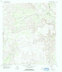
1963 Map of Garden City NE
USGS Topo · Published 1965About this map
The North Concho River winds through the northern portion of this West Texas landscape, defined by mid-century infrastructure and family ranching operations. Ranching life is anchored by the Foster Ranch and Hilltop Ranch, while the area's industrial character is shaped by a network of pipelines and water management facilities. The Big Spring City Wells and Garden City Pumping Sta indicate the critical role of water sourcing in this arid terrain. Farther south, the Clyde Reynolds Oil Field highlights the region's energy development, flanked by Dobson Creek and the Apple Creek drainage. Several scattered quarries and drill holes emphasize a landscape heavily utilized for natural resource extraction during the 1960s. The survey also clearly marks the boundary between Glasscock Co and Sterling Co, providing a precise record of land divisions in this rural Texas interior.
Find a feature on this map
16 named features on this map. Tap any name to fly to it.
Don’t see what you’re looking for? This feature index may not catch every label — zoom into the map to look around manually.
Map Details
Editions of this 1963 Garden City NE Map
2 editions found

Other maps of this area

1941 · Big Spring South
USGS Topo · 1:62,500

1942 · Big Spring South
USGS Topo · 1:62,500

1954 · Big Spring
USGS Topo · 1:250,000

1954 · San Angelo
USGS Topo · 1:250,000

1958 · San Angelo
USGS Topo · 1:250,000

1958 · Big Spring
USGS Topo · 1:250,000

1963 · Glass Ranch
USGS Topo · 1:24,000

1963 · Ballinger Ranch
USGS Topo · 1:24,000

1963 · Hayrick Mountain
USGS Topo · 1:24,000

1963 · Currie Reservoir
USGS Topo · 1:24,000