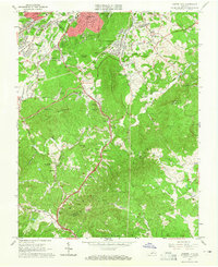
1963 Map of Garden City
USGS Topo · Published 1965About this map
The City of Roanoke meets the rugged slopes of Yellow Mountain and Buck Mountain in this mid-1960s study of the region's southern expansion. Suburban developments near Cave Spring and Garden City contrast with the winding path of the Blue Ridge Parkway, which traces the ridges above Back Creek. Educational and cultural growth is evident through the presence of the Roanoke Technical Institute and the Fine Arts Center, while the Norfolk and Western railroad remains a primary transportation artery through Starkey. Local life and leisure are captured by features like the Roanoke Drag Strip and Shrine Hill Park. For family historians, the sheet is dense with small burial grounds and rural houses of worship, including Gearhart Cem, Kingery Cem, and Piney Grove Ch, many located along the waters of Gills Creek.
Find a feature on this map
74 named features on this map. Tap any name to fly to it.
Don’t see what you’re looking for? This feature index may not catch every label — zoom into the map to look around manually.
Map Details
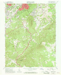
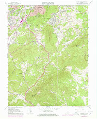
Editions of this 1963 Garden City Map
Other maps of this area

1890 · Roanoke
USGS Topo · 1:125,000

1890 · Christiansburg
USGS Topo · 1:125,000

1891 · Roanoke
USGS Topo · 1:125,000

1929 · Roanoke
USGS Topo · 1:48,000

1929 · Salem
USGS Topo · 1:48,000

1932 · Salem
USGS Topo · 1:62,500

1933 · Roanoke
USGS Topo · 1:62,500

1947 · Roanoke
USGS Topo · 1:250,000

1950 · Elliston
USGS Topo · 1:62,500

1951 · Boones Mill
USGS Topo · 1:62,500