
1947 Map of Garden Cove
USGS Topo · Published 1964About this map
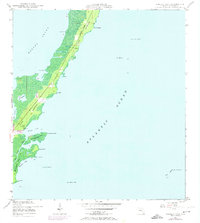
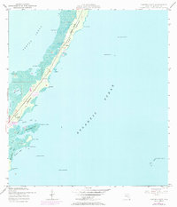
Key Largo stretches across this mid-century survey, showcasing the narrow land bridge between Barnes Sound and the Atlantic Ocean. The topography is dominated by the Basin Hills and the winding coastline of the upper Florida Keys, featuring distinct coastal markers like Point Mary and Point Elizabeth. This particular map captures the area before the massive modern development of the later 20th century, showing a sparsely settled landscape with isolated landmarks such as Knowlson and the House (South Gable). Internal water bodies like Lake Simmons and Lake Surprise are clearly defined, while maritime safety is represented by numerous offshore aids including Key Largo Beacon No 29 and Elbow Reef Beacon B. The mapping reflects 1946 aerial photography and 1947 ground surveys, documenting the intricate inlets of Garden Cove and Whitmore Bight as they appeared in the post-war era.
Find a feature on this map
26 named features on this map. Tap any name to fly to it.
Don’t see what you’re looking for? This feature index may not catch every label — zoom into the map to look around manually.
Map Details
Editions of this 1947 Garden Cove Map
3 editions found
Other maps of this area

1947 · Rock Harbor
USGS Topo · 1:24,000

1947 · Blackwater Sound
USGS Topo · 1:24,000

1949 · Blackwater Sound
USGS Topo · 1:24,000

1949 · Rock Harbor
USGS Topo · 1:24,000

1949 · Garden Cove
USGS Topo · 1:24,000

1949 · Card Sound
USGS Topo · 1:24,000

1949 · Pacific Reef
USGS Topo · 1:24,000

1950 · Glades
USGS Topo · 1:24,000

1956 · Card Sound
USGS Topo · 1:24,000
1956 · Pacific Reef
USGS Topo · 1:24,000