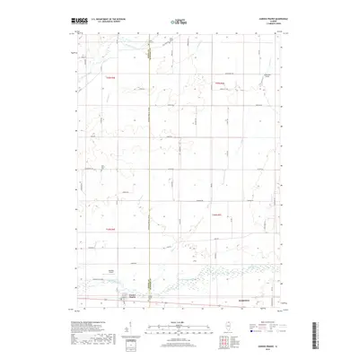
2018 Map of Garden Prairie
USGS Topo · Published 2018About this map
The Kishwaukee River flows through the southern portion of this landscape, anchoring a rural region where the border between Boone and McHenry counties is defined by the Boone Co McHenry Co Line Rd. The settlement of Garden Prairie sits at the southwestern edge, adjacent to the Garden Prairie Cem, while the western fringes of Marengo appear in the southeast. This area is characterized by a network of drainage systems including Piscasaw Creek, Rush Cr, and Mud Cr. Local aviation is represented by small airstrips such as Adkins RLA Airport and Kaufield Airport. Genealogists and local historians will find several rural burial grounds scattered throughout the township, including East Bonus Cem, Stone School Cem, and County Line Cem, which provide geographic markers for early family homesteads near the county line.
Find a feature on this map
43 named features on this map. Tap any name to fly to it.
Don’t see what you’re looking for? This feature index may not catch every label — zoom into the map to look around manually.
Map Details
Editions of this 2018 Garden Prairie Map
This is the sole edition of this map. No revisions or reprints were ever made.
Other maps of this area

1918 · Belvidere
USGS Topo · 1:62,500

1918 · Kirkland
USGS Topo · 1:62,500

1932 · Harvard
USGS Topo · 1:48,000

1937 · Harvard
USGS Topo · 1:62,500

1938 · Genoa
USGS Topo · 1:62,500

1944 · Belvidere
USGS Topo · 1:62,500

1954 · Rockford
USGS Topo · 1:250,000

1955 · Rockford
USGS Topo · 1:250,000

1958 · Rockford
USGS Topo · 1:250,000

1963 · Rockford
USGS Topo · 1:250,000