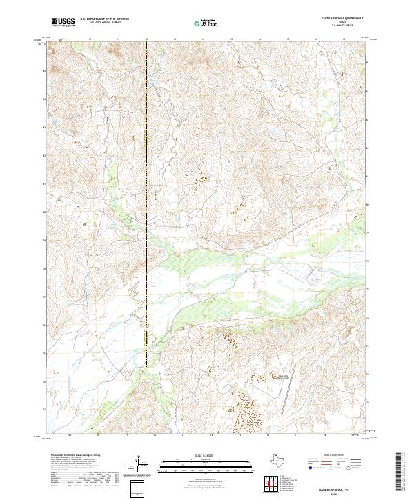
2022 Map of Garden Springs
USGS Topo · Published 2022About this map
The Canadian River cuts a wide, braided path through the heart of this landscape, marking a significant geological and historical divide between Hutchinson and Roberts counties. This river valley, characterized by complex drainage patterns, is fed by numerous tributaries including Johns Creek, Willow Creek, and Pats Creek. The topography is defined by the sharp transition from the flat river bottom to the deeply eroded canyonlands and breaks that rise toward the surrounding high plains.
Find a feature on this map
20 named features on this map. Tap any name to fly to it.
Don’t see what you’re looking for? This feature index may not catch every label — zoom into the map to look around manually.
Map Details
Editions of this 2022 Garden Springs Map
This is the sole edition of this map. No revisions or reprints were ever made.
Other maps of this area

1954 · Perryton
USGS Topo · 1:250,000

1954 · Amarillo
USGS Topo · 1:250,000

1958 · Perryton
USGS Topo · 1:250,000

1958 · Amarillo
USGS Topo · 1:250,000

1971 · Dry Creek South
USGS Topo · 1:24,000

1971 · Adobe Creek SW
USGS Topo · 1:24,000

1971 · Dry Creek North
USGS Topo · 1:24,000

1971 · Garden Springs
USGS Topo · 1:24,000

1971 · Adobe Creek SE
USGS Topo · 1:24,000

1973 · Sourdough Creek SW
USGS Topo · 1:24,000