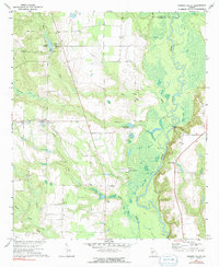
1971 Map of Garden Valley
USGS Topo · Published 1991About this map
Garden Valley and the surrounding rural landscapes of Taylor and Macon counties are defined by the winding course of the Flint River and a network of tributary creeks. The early 1970s environment shown here highlights a community centered around rural worship and local industry, with numerous historic congregations such as Corinth Ch, Rocky Mount Ch, and New Home Ch serving the area. Water played a central role in the local economy and geography, evidenced by the Hicks Millpond and Underwood Millpond, alongside the recreation or transit point at Miona Ferry. A distinct concentration of family-named landmarks like Hicks Cem and Turner Chapel Cem suggests deep generational roots in this part of Georgia. The landscape is further characterized by the marshy bottoms of Toteover Creek and Horse Creek, showing the natural drainage patterns that shaped local settlement and road placement.
Find a feature on this map
26 named features on this map. Tap any name to fly to it.
Don’t see what you’re looking for? This feature index may not catch every label — zoom into the map to look around manually.
Map Details
Editions of this 1971 Garden Valley Map
2 editions found

Other maps of this area

1955 · Phenix City
USGS Topo · 1:250,000

1956 · Fort Valley
USGS Topo · 1:62,500

1957 · Phenix City
USGS Topo · 1:250,000

1957 · Macon
USGS Topo · 1:250,000

1958 · Macon
USGS Topo · 1:250,000

1958 · Phenix City
USGS Topo · 1:250,000

1964 · Macon
USGS Topo · 1:250,000

1971 · Ideal South
USGS Topo · 1:24,000

1971 · Reynolds
USGS Topo · 1:24,000

1971 · Ideal North
USGS Topo · 1:24,000