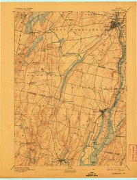
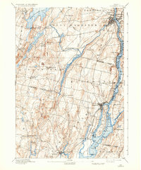
1892 Map of Gardiner
USGS Topo · Published 1906About this map
The Kennebec River corridor dominates this late 19th-century survey, revealing a landscape defined by water-dependent industries and early rail transit. Settlements like Gardiner, Richmond, and Bowdoinham anchor the riverbanks, while the Maine Central Railroad traces the western shore, connecting busy centers of trade. On the river itself, Swan Island and Little Swan Island sit at the confluence of the Abagadassett River and Eastern River, highlighting the intricate network of tidal channels and points that served Maine's maritime economy.
Find a feature on this map
88 named features on this map. Tap any name to fly to it.
Don’t see what you’re looking for? This feature index may not catch every label — zoom into the map to look around manually.
Map Details
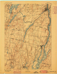
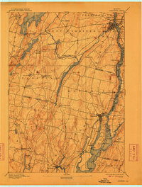
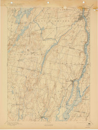
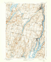
Editions of this 1892 Gardiner Map
7 editions found
Other maps of this area

1892 · Gardiner
USGS Topo · 1:62,500

1892 · Freeport
USGS Topo · 1:62,500

1892 · Augusta
USGS Topo · 1:62,500

1893 · Vassalboro
USGS Topo · 1:62,500

1893 · Wiscasset
USGS Topo · 1:62,500

1893 · Boothbay
USGS Topo · 1:62,500

1894 · Bath
USGS Topo · 1:62,500

1898 · Vassalboro
USGS Topo · 1:62,500

1908 · Lewiston
USGS Topo · 1:62,500

1910 · Livermore
USGS Topo · 1:62,500