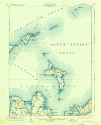
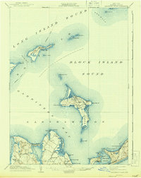
1904 Map of Gardiners Island
USGS Topo · Published 1935About this map
Gardiners Island dominates this maritime survey, showing the land as it was organized shortly after the Spanish-American War. The landscape is marked by unique coastal features like Tobacco Lot Pond and Whale Hill, while Gardiners Bay separates the island from the mainland settlements of Springs and Kingstown. The military presence of the era is evidenced by Fort Terry on Plum Island, a strategic position near the treacherous waters of The Race and Plum Gut. To the south, the Montauk Div. Long Island R. R. follows the narrow neck toward Napeague Harbor, connecting landings such as Quincetree Landing and Alberts Landing. This map captures a coastal economy defined by steamboat routes and small, scattered shorefront communities before modern development transformed the eastern end of Long Island.
Find a feature on this map
66 named features on this map. Tap any name to fly to it.
Don’t see what you’re looking for? This feature index may not catch every label — zoom into the map to look around manually.
Map Details
Editions of this 1904 Gardiners Island Map
6 editions found

Other maps of this area

1889 · Stonington
USGS Topo · 1:62,500

1892 · New London
USGS Topo · 1:62,500

1893 · Stonington
USGS Topo · 1:62,500

1893 · New London
USGS Topo · 1:62,500

1893 · Saybrook
USGS Topo · 1:62,500

1903 · Sag Harbor
USGS Topo · 1:62,500

1903 · Gardiners Island
USGS Topo · 1:62,500

1904 · Sag Harbor
USGS Topo · 1:62,500

1904 · Shelter Island
USGS Topo · 1:62,500

1904 · Easthampton
USGS Topo · 1:62,500
Featured Places
- East Hampton, NY
- Southold, NY
- Springs, East Hampton
- Northwest Harbor, East Hampton
- Montauk, East Hampton