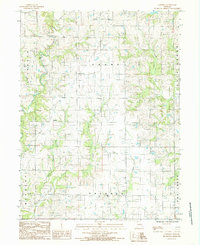
1984 Map of Gardner
USGS Topo · Published 1985About this map
Gardner sits as the central settlement in this agricultural pocket of Harrison County during the mid-1980s. The landscape is defined by the branching tributaries of the Big Creek system, including the East Fork Big Creek and the meandering Polecat Creek. Evidence of earlier transport networks is visible in the corridor of the Old Railroad, which once provided the vital connection for the grain and livestock economy of these rural townships. The terrain transitions between Jefferson, Grant, and Sherman townships, where small family Cem sites and farmsteads are scattered among the ridges. A modern Radio Tower stands near the northern boundary, marking a shift in the local infrastructure as the region moved further into the late twentieth century.
Find a feature on this map
16 named features on this map. Tap any name to fly to it.
Don’t see what you’re looking for? This feature index may not catch every label — zoom into the map to look around manually.
Map Details
Editions of this 1984 Gardner Map
This is the sole edition of this map. No revisions or reprints were ever made.
Other maps of this area

1925 · Pattonsburg
USGS Topo · 1:62,500

1925 · Gilman
USGS Topo · 1:62,500

1944 · Pattonsburg
USGS Topo · 1:62,500

1946 · Gilman
USGS Topo · 1:48,000

1946 · Pattonsburg
USGS Topo · 1:48,000

1947 · Blythedale
USGS Topo · 1:62,500

1948 · Gilman
USGS Topo · 1:62,500

1948 · Bethany
USGS Topo · 1:62,500

1948 · Pattonsburg
USGS Topo · 1:62,500

1954 · Centerville
USGS Topo · 1:250,000