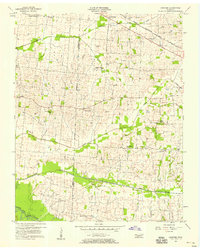
1956 Map of Gardner
USGS Topo · Published 1958About this map
Gardner serves as a primary settlement node along the Nashville Chattanooga and St Louis railroad in this mid-1950s depiction of the borderlands between Weakley and Obion counties. The landscape is defined by the eastward-flowing tributaries of the South Fork Obion River, including Cypress Creek, Cane Creek, and Mud Creek. These watercourses dictate the rural settlement patterns, with family-named cemeteries such as Calicott Cem and Taylor Cem scattered across the higher ground between the creek bottoms.
Find a feature on this map
35 named features on this map. Tap any name to fly to it.
Don’t see what you’re looking for? This feature index may not catch every label — zoom into the map to look around manually.
Map Details
Editions of this 1956 Gardner Map
3 editions found
Other maps of this area

1950 · Martin
USGS Topo · 1:24,000

1950 · Rives
USGS Topo · 1:24,000

1951 · Rives
USGS Topo · 1:24,000

1954 · Rutherford
USGS Topo · 1:24,000

1954 · Greenfield
USGS Topo · 1:24,000

1954 · Union City
USGS Topo · 1:24,000

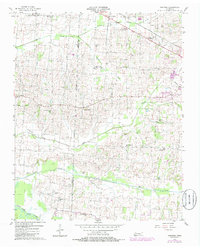
1956 · Gardner
USGS Topo · 1:24,000

1956 · Harris
USGS Topo · 1:24,000

1956 · Mc Connell
USGS Topo · 1:24,000

1956 · Dyersburg
USGS Topo · 1:250,000