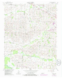
1956 Map of Gardner
USGS Topo · Published 1985About this map
The Obion County and Weakley County line bisects this West Tennessee landscape, where small rural settlements like Gardner and Mount Pelia anchor a network of agricultural lands. The terrain is defined by the northward flow of Cypress Creek and Cane Creek, eventually reaching the South Fork Obion River at the map's southern edge. In the northwest corner, the Everett Stewart Airport stands as a modern infrastructure point amidst a dense concentration of historical markers. This survey is particularly valuable for genealogical research, documenting numerous family-named burial grounds such as McKinney Cemetery, Collier Cemetery, and Hurt Cemetery. The map captures a transition period in 1956, with subsequent revisions showing developments near the outskirts of Martin, providing a clear record of land use and small-town community centers like the Stella Ruth Community Center during the mid-20th century.
Find a feature on this map
36 named features on this map. Tap any name to fly to it.
Don’t see what you’re looking for? This feature index may not catch every label — zoom into the map to look around manually.
Map Details
Editions of this 1956 Gardner Map
3 editions found
Other maps of this area

1950 · Martin
USGS Topo · 1:24,000

1950 · Rives
USGS Topo · 1:24,000

1951 · Rives
USGS Topo · 1:24,000

1954 · Rutherford
USGS Topo · 1:24,000

1954 · Greenfield
USGS Topo · 1:24,000

1954 · Union City
USGS Topo · 1:24,000

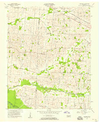
1956 · Gardner
USGS Topo · 1:24,000

1956 · Harris
USGS Topo · 1:24,000

1956 · Mc Connell
USGS Topo · 1:24,000

1956 · Dyersburg
USGS Topo · 1:250,000