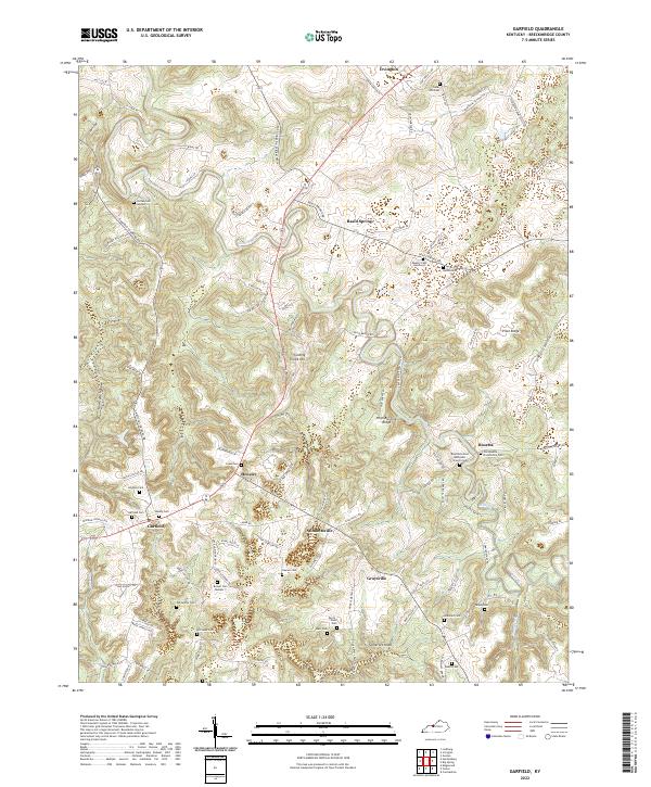
2022 Map of Garfield
USGS Topo · Published 2022About this map
Sinking Creek winds through a landscape of karst features and clustered rural settlements in this modern survey of Breckinridge County. The terrain is defined by its numerous family and community burial grounds, including the Old Rosetta Community Cem and Jordan Cem Number 1, reflecting a deep genealogical footprint across the hills of Rosetta and Garfield. Small crossroads communities such as Stinnettsville, Graysville, and Hensley are connected by a dense network of local roads, while Irvington serves as the northern anchor. The presence of Freedom Church Spr and the Rosetta United Methodist Church Cem highlights the religious and social centers of this agricultural region. Notable topographic landmarks like Somerset Knob and Pilot Ridge provide vertical relief in an area otherwise characterized by hollows like Hurricane Hollow and the subterranean drainage patterns typical of this Kentucky geography.
Find a feature on this map
105 named features on this map. Tap any name to fly to it.
Don’t see what you’re looking for? This feature index may not catch every label — zoom into the map to look around manually.
Map Details
Editions of this 2022 Garfield Map
This is the sole edition of this map. No revisions or reprints were ever made.
Other maps of this area

1928 · Hardinsburg
USGS Topo · 1:48,000

1931 · Hardinsburg
USGS Topo · 1:62,500

1932 · Big Clifty
USGS Topo · 1:62,500

1941 · Ekron
USGS Topo · 1:62,500

1947 · Irvington
USGS Topo · 1:24,000

1947 · Lodiburg
USGS Topo · 1:24,000

1947 · Hardinsburg
USGS Topo · 1:24,000

1947 · Garfield
USGS Topo · 1:24,000

1947 · Hardinsburg
USGS Topo · 1:62,500

1947 · Ekron
USGS Topo · 1:62,500