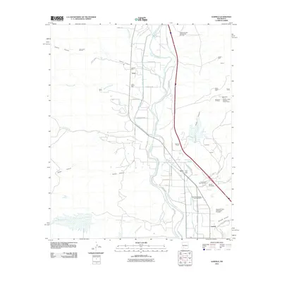
2010 Map of Garfield
USGS Topo · Published 2010About this map
The Rio Grande corridor in southern New Mexico serves as the central artery for a complex network of agricultural irrigation and mineral extraction. This 2010 survey details the communities of Arrey, Derry, and Garfield, where life is organized around water management systems like the Arrey Canal, Bonita Community Ditch, and the Gonzalez Lateral. These man-made features contrast with the natural drainage of Trujillo Canyon and Tierra Blanca Creek, which feed into the valley from the surrounding heights.
Find a feature on this map
66 named features on this map. Tap any name to fly to it.
Don’t see what you’re looking for? This feature index may not catch every label — zoom into the map to look around manually.
Map Details
Editions of this 2010 Garfield Map
This is the sole edition of this map. No revisions or reprints were ever made.
Other maps of this area

1955 · Las Cruces
USGS Topo · 1:250,000

1958 · Las Cruces
USGS Topo · 1:250,000

1958 · Arroyo Cuervo
USGS Topo · 1:24,000

1959 · Hatch
USGS Topo · 1:24,000

1959 · Upham
USGS Topo · 1:62,500

1961 · Skute Stone Arroyo
USGS Topo · 1:24,000

1961 · Caballo
USGS Topo · 1:24,000

1961 · Nutt
USGS Topo · 1:62,500

1961 · Clark Spring Canyon
USGS Topo · 1:24,000

1961 · Garfield
USGS Topo · 1:24,000