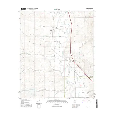
2017 Map of Garfield
USGS Topo · Published 2017About this map
Rincon Valley agriculture and the lifeblood of the Rio Grande define this stretch of the southern New Mexico landscape. The small communities of Arrey, Derry, and Garfield are tethered to a sophisticated network of water management, including the Percha Lateral, Trujillo Lateral, and Arrey Canal. This system of ditches and drains transformed the arid terrain into a productive valley, a pattern clearly visible in the transition from the irrigated lowlands to the dissected mesas of Trujillo Canyon and Sibley Canyon to the west. Local landmarks like Derry Warm Spring and Libby Spring highlight the unique hydrologic features that drew settlers to this region. The map also records the crossing of the Sierra Co Doña Ana Co line, illustrating the administrative boundaries that split this rural corridor just north of the Garfield settlement.
Find a feature on this map
77 named features on this map. Tap any name to fly to it.
Don’t see what you’re looking for? This feature index may not catch every label — zoom into the map to look around manually.
Map Details
Editions of this 2017 Garfield Map
This is the sole edition of this map. No revisions or reprints were ever made.
Other maps of this area

1955 · Las Cruces
USGS Topo · 1:250,000

1958 · Las Cruces
USGS Topo · 1:250,000

1958 · Arroyo Cuervo
USGS Topo · 1:24,000

1959 · Hatch
USGS Topo · 1:24,000

1959 · Upham
USGS Topo · 1:62,500

1961 · Skute Stone Arroyo
USGS Topo · 1:24,000

1961 · Caballo
USGS Topo · 1:24,000

1961 · Nutt
USGS Topo · 1:62,500

1961 · Clark Spring Canyon
USGS Topo · 1:24,000

1961 · Garfield
USGS Topo · 1:24,000