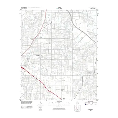
2010 Map of Garland
USGS Topo · Published 2010About this map
Garland and Richardson anchor this dense suburban landscape in northern Dallas County, where early 21st-century residential developments have fully integrated smaller, older locales like Buckingham, Audelia, and Shiloh. The map reveals a complex web of modern infrastructure, from the Richardson Square Mall and the Garland/Dallas-Fort Worth Heloplex to a high density of postal facilities such as the Kingsley Post Office and Huffhines Park Post Office.
Find a feature on this map
59 named features on this map. Tap any name to fly to it.
Don’t see what you’re looking for? This feature index may not catch every label — zoom into the map to look around manually.
Map Details
Editions of this 2010 Garland Map
This is the sole edition of this map. No revisions or reprints were ever made.
Other maps of this area

1891 · Dallas
USGS Topo · 1:125,000

1893 · Dallas
USGS Topo · 1:125,000

1924 · Mc Kinney 4-d
USGS Topo · 1:48,000

1929 · Frisco
USGS Topo · 1:62,500

1929 · McKinney
USGS Topo · 1:62,500

1931 · Carrollton
USGS Topo · 1:62,500

1954 · Dallas
USGS Topo · 1:250,000

1954 · Sherman
USGS Topo · 1:250,000

1957 · White Rock Lake
USGS Topo · 1:24,000

1958 · Dallas
USGS Topo · 1:250,000