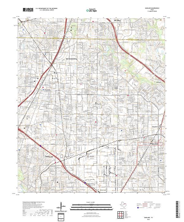
2022 Map of Garland
USGS Topo · Published 2022About this map
Garland and its surrounding suburbs appear here as a dense suburban landscape in the early twenty-first century, defined by a complex grid of residential streets and major arterial highways. The northern reaches of the sheet are marked by the Collin Co Dallas Co line, where the cities of Plano and Richardson merge seamlessly into the metropolitan fabric. Local history and genealogy are anchored by several notable burial grounds, including the Jacob Routh Family Cem and the Pioneer Cem, which reflect the area's deep roots before the modern expansion.
Find a feature on this map
40 named features on this map. Tap any name to fly to it.
Don’t see what you’re looking for? This feature index may not catch every label — zoom into the map to look around manually.
Map Details
Editions of this 2022 Garland Map
This is the sole edition of this map. No revisions or reprints were ever made.
Other maps of this area

1891 · Dallas
USGS Topo · 1:125,000

1893 · Dallas
USGS Topo · 1:125,000

1924 · Mc Kinney 4-d
USGS Topo · 1:48,000

1929 · Frisco
USGS Topo · 1:62,500

1929 · McKinney
USGS Topo · 1:62,500

1931 · Carrollton
USGS Topo · 1:62,500

1954 · Dallas
USGS Topo · 1:250,000

1954 · Sherman
USGS Topo · 1:250,000

1957 · White Rock Lake
USGS Topo · 1:24,000

1958 · Dallas
USGS Topo · 1:250,000