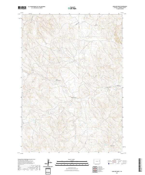
2021 Map of Garland Draw
USGS Topo · Published 2021About this map
Snyder Creek and its tributary, S Snyder Creek, define the drainage patterns of this high plains landscape in eastern Wyoming. The terrain is characterized by a dense network of intermittent watercourses including Garland Draw, Dixon Draw, and Barrel Draw, which illustrate the erosion patterns typical of this part of Niobrara County. Human infrastructure is notably sparse, represented primarily by Dixon Rd, which provides north-south access through the sections. The map's detailed topography reveals the functional naming of the land by cattlemen and homesteaders, seen in features like Windmill Draw, Clayton Draw, and North Pasture Draw. This 2021 survey by the U.S. Geological Survey preserves the Public Land Survey System grid across townships including t40n r65w and t41n r66w, anchoring these local landmarks within the legal geography of the American West.
Find a feature on this map
16 named features on this map. Tap any name to fly to it.
Don’t see what you’re looking for? This feature index may not catch every label — zoom into the map to look around manually.
Map Details
Editions of this 2021 Garland Draw Map
This is the sole edition of this map. No revisions or reprints were ever made.
Other maps of this area

1955 · Newcastle
USGS Topo · 1:250,000

1958 · Newcastle
USGS Topo · 1:250,000

1979 · Newcastle
USGS Topo · 1:100,000

1981 · Calf Draw
USGS Topo · 1:24,000

1981 · Horseshoe Bend
USGS Topo · 1:24,000

1981 · Dixon Ranch
USGS Topo · 1:24,000
1981 · Boggy Reservoir
USGS Topo · 1:24,000

1981 · Garland Draw
USGS Topo · 1:24,000

1981 · Wagonhound Creek NE
USGS Topo · 1:24,000

1981 · Lance Creek
USGS Topo · 1:100,000