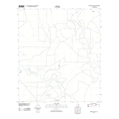
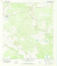
2010 Map of Garner Field NE
USGS Topo · Published 2010About this map
Frio River flows through this corner of Uvalde County, where the southern Texas landscape is defined by its drainages and early 21st-century water management. The topography is marked by several significant embankments, including Frank Kincaid Lake Number 1 Dam in the south and both Reagan Lake Dam and Corder Lake Dam further north. These structures indicate the regional reliance on surface water storage within a terrain shaped by Long Hollow and the wandering paths of Blanco Creek and Dinner Creek. While the area remains largely rural and sparse, the presence of Co RD 307 and other local tracks provides insight into the transportation network connecting these water sources and ranch lands as they appeared in 2010.
Find a feature on this map
8 named features on this map. Tap any name to fly to it.
Don’t see what you’re looking for? This feature index may not catch every label — zoom into the map to look around manually.
Map Details
Editions of this 2010 Garner Field NE Map
This is the sole edition of this map. No revisions or reprints were ever made.
Other maps of this area

1898 · Uvalde
USGS Topo · 1:125,000

1899 · Uvalde
USGS Topo · 1:125,000

1928 · Frio Town
USGS Topo · 1:62,500

1954 · San Antonio
USGS Topo · 1:250,000

1956 · Sabinal
USGS Topo · 1:62,500

1957 · San Antonio
USGS Topo · 1:250,000
1970 · Irishman Hill
USGS Topo · 1:24,000
1970 · Sabinal
USGS Topo · 1:24,000
1971 · Garner Field NE
USGS Topo · 1:24,000
1971 · Garner Field
USGS Topo · 1:24,000