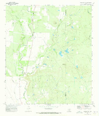
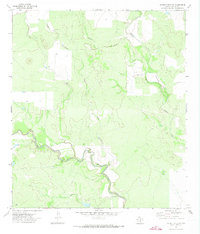
1970 Map of Irishman Hill
USGS Topo · Published 1973About this map
The Sabinal River flows through this 1970 study of the border between Uvalde and Medina counties, revealing a landscape defined by ranching and light aviation. Two prominent topographic landmarks, Pilot Knob and Irishman Hill, rise above the surrounding terrain of interlocking creek beds, including East Elm Creek and Blanco Creek. Local history is anchored by the Brown Cem in the north, while the presence of a Landing Strip and numerous wells suggest a working landscape of mid-century land management. The map's detailed mapping of fence lines, noted in the margin, provides a clear view of the property divisions and land-use patterns that shaped this rural Texas corridor during the early 1970s.
Find a feature on this map
13 named features on this map. Tap any name to fly to it.
Don’t see what you’re looking for? This feature index may not catch every label — zoom into the map to look around manually.
Map Details
Editions of this 1970 Irishman Hill Map
This is the sole edition of this map. No revisions or reprints were ever made.
Other maps of this area

1898 · Uvalde
USGS Topo · 1:125,000

1899 · Uvalde
USGS Topo · 1:125,000

1928 · Frio Town
USGS Topo · 1:62,500

1954 · San Antonio
USGS Topo · 1:250,000

1956 · Sabinal
USGS Topo · 1:62,500

1957 · San Antonio
USGS Topo · 1:250,000
1970 · D'hanis
USGS Topo · 1:24,000
1970 · Sabinal
USGS Topo · 1:24,000
1970 · Frio Town NE
USGS Topo · 1:24,000
1971 · Garner Field NE
USGS Topo · 1:24,000