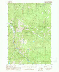
1988 Map of Garnet Mountain
USGS Topo · Published 1988About this map
The Gallatin River carves a deep valley through the heart of the Gallatin National Forest, serving as a primary corridor for travel and settlement in this corner of Montana. High above the river, the Garnet Mountain Lookout Tower stands atop Garnet Mountain, providing a strategic vantage point for forest management. This 1980s landscape is characterized by its complex network of watercourses and protected lands, including the eastern reaches of the Lee Metcalf Wilderness south of the Canyon Creek boundary. Notable landmarks like the Squaw Creek Forest Service Station and various campgrounds indicate the area's role as a hub for both government administration and public recreation. High-elevation features such as Storm Castle and Lava Lake define the challenging terrain, while the presence of a Pack Trail suggests the reliance on traditional routes for navigating the backcountry.
Find a feature on this map
44 named features on this map. Tap any name to fly to it.
Don’t see what you’re looking for? This feature index may not catch every label — zoom into the map to look around manually.
Map Details
Editions of this 1988 Garnet Mountain Map
2 editions found
Other maps of this area

1888 · Three Forks
USGS Topo · 1:250,000

1894 · Three Forks
USGS Topo · 1:250,000

1895 · Three Forks
USGS Topo · 1:250,000

1947 · Bozeman
USGS Topo · 1:250,000

1948 · Bozeman
USGS Topo · 1:250,000

1949 · Anceney
USGS Topo · 1:62,500

1950 · Spanish Peaks
USGS Topo · 1:62,500

1953 · Bozeman
USGS Topo · 1:62,500

1955 · Bozeman
USGS Topo · 1:250,000

1955 · Garnet Mountain
USGS Topo · 1:62,500