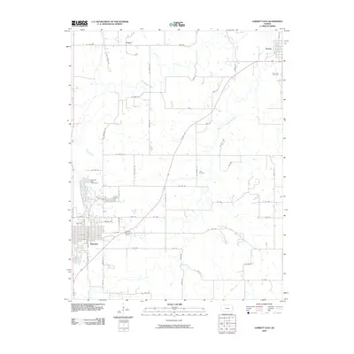
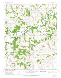
2009 Map of Garnett East
USGS Topo · Published 2009About this map
Garnett serves as a focal point for this Anderson County landscape, showing the town's grid stretching east from Main St toward the Garnett Municipal Airport. The area’s geography is defined by the winding course of Pottawatomie Creek and its South Fork, which intersect north and east of the main settlement. Small communities like Greeley in the northeast and Scipio in the northwest are connected by an extensive network of rural routes, including US Hwy 169 cutting diagonally across the quadrangle.
Find a feature on this map
56 named features on this map. Tap any name to fly to it.
Don’t see what you’re looking for? This feature index may not catch every label — zoom into the map to look around manually.
Map Details
Editions of this 2009 Garnett East Map
This is the sole edition of this map. No revisions or reprints were ever made.
Other maps of this area

1885 · Garnett
USGS Topo · 1:125,000

1894 · Garnett
USGS Topo · 1:125,000

1947 · Lawrence
USGS Topo · 1:250,000

1950 · Lawrence
USGS Topo · 1:250,000

1956 · Lawrence
USGS Topo · 1:250,000

1961 · Lawrence
USGS Topo · 1:250,000
1965 · Richmond
USGS Topo · 1:24,000
1966 · Bush City
USGS Topo · 1:24,000
1966 · Garnett East
USGS Topo · 1:24,000
1966 · Lane
USGS Topo · 1:24,000