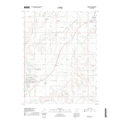
2018 Map of Garnett East
USGS Topo · Published 2018About this map
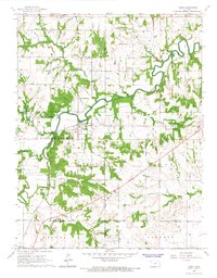
Garnett and its surrounding rural townships in Anderson County are defined by a landscape of meandering watercourses and established transportation corridors. The Pottawatomie Cr and its S Fork Pottawatomie Cr wind through the terrain, historically shaping the settlement patterns of towns like Greeley and the community of Scipio. The Prairie Spirit Rail Trail follows an old rail alignment north from Garnett, cutting a diagonal path across the western half of the sheet. For those researching local history, the map provides precise locations for several rural burying grounds, including Saint Boniface Catholic Cem, Judy Cem, and Saint John Cem. These sites, along with the Garnett Municipal Airport, reveal how modern infrastructure and 19th-century foundations coexist in this corner of eastern Kansas.
Find a feature on this map
86 named features on this map. Tap any name to fly to it.
Don’t see what you’re looking for? This feature index may not catch every label — zoom into the map to look around manually.
Map Details
Editions of this 2018 Garnett East Map
This is the sole edition of this map. No revisions or reprints were ever made.
Other maps of this area

1885 · Garnett
USGS Topo · 1:125,000

1894 · Garnett
USGS Topo · 1:125,000

1947 · Lawrence
USGS Topo · 1:250,000

1950 · Lawrence
USGS Topo · 1:250,000

1956 · Lawrence
USGS Topo · 1:250,000

1961 · Lawrence
USGS Topo · 1:250,000
1965 · Richmond
USGS Topo · 1:24,000
1966 · Bush City
USGS Topo · 1:24,000
1966 · Garnett East
USGS Topo · 1:24,000
1966 · Lane
USGS Topo · 1:24,000