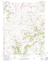
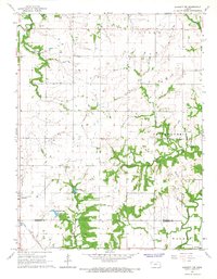
1966 Map of Garnett NW
USGS Topo · Published 1983About this map
The Atchison Topeka and Santa Fe railroad corridor defines the western edge of this landscape, passing through Richmond as it traverses the boundary between Franklin and Anderson counties. This mid-century survey reveals a transition from the agricultural uplands of Cutler and Ohio townships down into the intricate drainage basin of the Pottawatomie Creek system. Water features dominate the central and southern terrain, including Richmond Lake, Gilkey Lake, and the convergence of the North Fork and South Fork Pottawatomie Creek. Rural life is anchored by several long-standing landmarks, from the Community Center in the north to the Berea Cem and Baker Cem, providing essential points of reference for genealogists tracing family roots in this corner of Kansas. Small-scale resource extraction is also evident through scattered Oil Wells and a Quarry near the Sac Branch.
Find a feature on this map
25 named features on this map. Tap any name to fly to it.
Don’t see what you’re looking for? This feature index may not catch every label — zoom into the map to look around manually.
Map Details
Editions of this 1966 Garnett NW Map
2 editions found
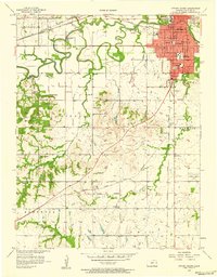
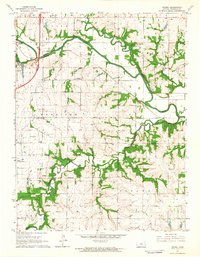
Other maps of this area

1885 · Garnett
USGS Topo · 1:125,000

1885 · Lawrence
USGS Topo · 1:125,000

1889 · Lawrence
USGS Topo · 1:125,000

1894 · Garnett
USGS Topo · 1:125,000

1947 · Lawrence
USGS Topo · 1:250,000

1950 · Lawrence
USGS Topo · 1:250,000
1956 · Ottawa South
USGS Topo · 1:24,000

1956 · Lawrence
USGS Topo · 1:250,000

1961 · Lawrence
USGS Topo · 1:250,000
1962 · Peoria
USGS Topo · 1:24,000