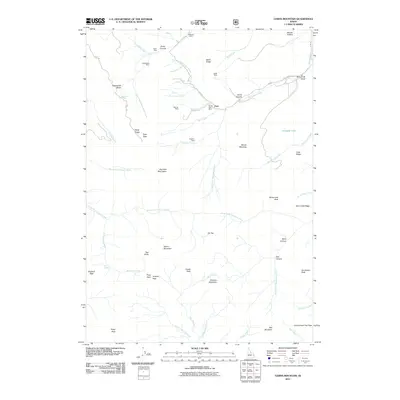
2011 Map of Garns Mountain
USGS Topo · Published 2011About this map
Garns Mountain and the high Big Hole Mountains dominate this landscape, characterized by a complex network of canyons and ridges defined by early 21st-century mining and wilderness access. The high density of named mining sites, including the Mikesell Mine, Packsaddle Mine, and the cluster of the Hillman Mine and Brown Bear Mine along Hillman Creek, suggests a legacy of prospecting and resource extraction in these Teton County heights.
Find a feature on this map
66 named features on this map. Tap any name to fly to it.
Don’t see what you’re looking for? This feature index may not catch every label — zoom into the map to look around manually.
Map Details
Editions of this 2011 Garns Mountain Map
This is the sole edition of this map. No revisions or reprints were ever made.
Other maps of this area

1943 · Driggs
USGS Topo · 1:62,500

1943 · Garns Mtn
USGS Topo · 1:62,500

1946 · Driggs
USGS Topo · 1:62,500

1946 · Garns Mtn
USGS Topo · 1:62,500

1955 · Driggs
USGS Topo · 1:250,000

1958 · Driggs
USGS Topo · 1:250,000

1962 · Driggs
USGS Topo · 1:250,000

1965 · Packsaddle Lake
USGS Topo · 1:24,000
1965 · Wright Creek
USGS Topo · 1:24,000
1965 · Tetonia
USGS Topo · 1:24,000