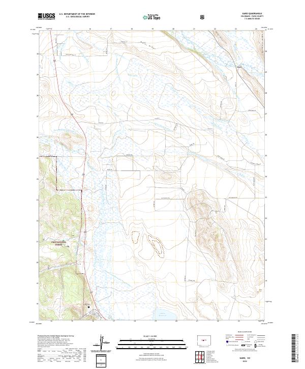
2022 Map of Garo
USGS Topo · Published 2022About this map
The settlement of Garo and the expansive waters of the Antero Reservoir anchor this high-altitude landscape in Park County. The map reveals an intricate network of irrigation engineering, where numerous water rights are codified through named channels like the Elisha-Alden Ditch, Nelson Ditch Number 3, and the Antero-Feeder Ditch. These diversions draw from the Middle Fork South Platte River and the South Fork Platte River, reflecting a complex history of water management essential for ranching in this arid environment. The terrain is defined by prominent landforms such as Meier Ridge, Red Hill, and Reinecker Ridge, while the southwestern corner transitions into the protected timberlands of the Pike National Forest. Genealogists and local historians will find the Buffalo Springs Cem near Deadman Gulch, providing a point of interest for tracing early families in the region.
Find a feature on this map
57 named features on this map. Tap any name to fly to it.
Don’t see what you’re looking for? This feature index may not catch every label — zoom into the map to look around manually.
Map Details
Editions of this 2022 Garo Map
This is the sole edition of this map. No revisions or reprints were ever made.
Other maps of this area

1889 · Leadville
USGS Topo · 1:125,000

1891 · Leadville
USGS Topo · 1:125,000

1942 · Leadville
USGS Topo · 1:125,000

1953 · Denver
USGS Topo · 1:250,000

1954 · Pueblo
USGS Topo · 1:250,000

1955 · Buena Vista
USGS Topo · 1:62,500

1956 · Elkhorn
USGS Topo · 1:24,000

1956 · Garo
USGS Topo · 1:24,000

1956 · Antero Reservoir
USGS Topo · 1:24,000

1956 · Antero Reservoir NE
USGS Topo · 1:24,000