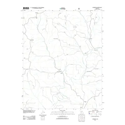
2012 Map of Garrison
USGS Topo · Published 2012About this map
Swan Creek and its many tributaries carve through the upland landscape of Christian County, defining the settlement patterns of this Missouri region. Small communities such as Garrison and Swan are situated along the winding valley floors, connected by a network of rural routes like Peace Rd and Cromwell Rd. The geography is characterized by prominent high ground, including Blue Ridge, Devreaux Ridge, and Garrison Ridge, which overlook numerous named hollows such as Hodge Hollow and Poague Hollow.
Find a feature on this map
49 named features on this map. Tap any name to fly to it.
Don’t see what you’re looking for? This feature index may not catch every label — zoom into the map to look around manually.
Map Details
Editions of this 2012 Garrison Map
This is the sole edition of this map. No revisions or reprints were ever made.
Other maps of this area

1907 · Forsyth
USGS Topo · 1:125,000

1937 · Bradleyville
USGS Topo · 1:48,000

1943 · Protem
USGS Topo · 1:62,500

1943 · Bradleyville
USGS Topo · 1:62,500

1945 · Harrison
USGS Topo · 1:250,000

1945 · Bradleyville
USGS Topo · 1:62,500

1949 · Harrison
USGS Topo · 1:250,000

1954 · Harrison
USGS Topo · 1:250,000

1955 · Garrison
USGS Topo · 1:24,000
1955 · Selmore
USGS Topo · 1:24,000