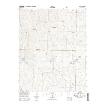
2015 Map of Garrison
USGS Topo · Published 2015About this map
Swan Cr winds through a heavily dissected landscape defined by the Mark Twain National Forest along the border of Christian and Taney counties. This 2015 U.S. Geological Survey representation highlights the enduring settlement patterns of the Ozark highlands, where small communities like Garrison and Swan are linked by a network of ridge-running roads such as Blue Ridge Rd and Garrison Rd. Local history is anchored by family and community landmarks, including Peace Cemetery, Swan Cemetery, and Helphrey Cemetery, which are often situated near topographic high points like Helphrey Hill. The map meticulously details the complex drainage systems of the region, featuring named hollows such as Surratt Hollow and Hodge Hollow that feed into primary watercourses like Blue Creek.
Find a feature on this map
56 named features on this map. Tap any name to fly to it.
Don’t see what you’re looking for? This feature index may not catch every label — zoom into the map to look around manually.
Map Details
Editions of this 2015 Garrison Map
This is the sole edition of this map. No revisions or reprints were ever made.
Other maps of this area

1907 · Forsyth
USGS Topo · 1:125,000

1937 · Bradleyville
USGS Topo · 1:48,000

1943 · Protem
USGS Topo · 1:62,500

1943 · Bradleyville
USGS Topo · 1:62,500

1945 · Harrison
USGS Topo · 1:250,000

1945 · Bradleyville
USGS Topo · 1:62,500

1949 · Harrison
USGS Topo · 1:250,000

1954 · Harrison
USGS Topo · 1:250,000

1955 · Garrison
USGS Topo · 1:24,000
1955 · Selmore
USGS Topo · 1:24,000