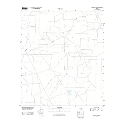
2010 Map of Garrison Draw
USGS Topo · Published 2010About this map
Centralia Draw and Garrison Draw define the drainage of this arid West Texas landscape, showing the sparse but vital water infrastructure of the Permian Basin region. The map reveals the persistence of ranching operations through several named landmarks, including Shamlin Windmill and Dipping Vat Windmill, which speak to the area's agricultural history. Local transportation is managed by a grid of named routes like Yocham Rd and Turner Rd, alongside the more modern Fm 1555. The presence of the Eclipse Windmill further underscores the reliance on groundwater for sustaining the isolated homesteads and livestock operations that characterize this portion of Reagan County.
Find a feature on this map
13 named features on this map. Tap any name to fly to it.
Don’t see what you’re looking for? This feature index may not catch every label — zoom into the map to look around manually.
Map Details
Editions of this 2010 Garrison Draw Map
This is the sole edition of this map. No revisions or reprints were ever made.
Other maps of this area

1928 · Rankin
USGS Topo · 1:125,000

1954 · San Angelo
USGS Topo · 1:250,000

1958 · San Angelo
USGS Topo · 1:250,000

1965 · San Angelo
USGS Topo · 1:250,000

1970 · Sevenmile Corner NE
USGS Topo · 1:24,000

1970 · Stiles NW
USGS Topo · 1:24,000

1970 · Sevenmile Corner SE
USGS Topo · 1:24,000
1970 · Rankin NE
USGS Topo · 1:24,000

1970 · Garrison Draw
USGS Topo · 1:24,000

1970 · Gardener Draw
USGS Topo · 1:24,000