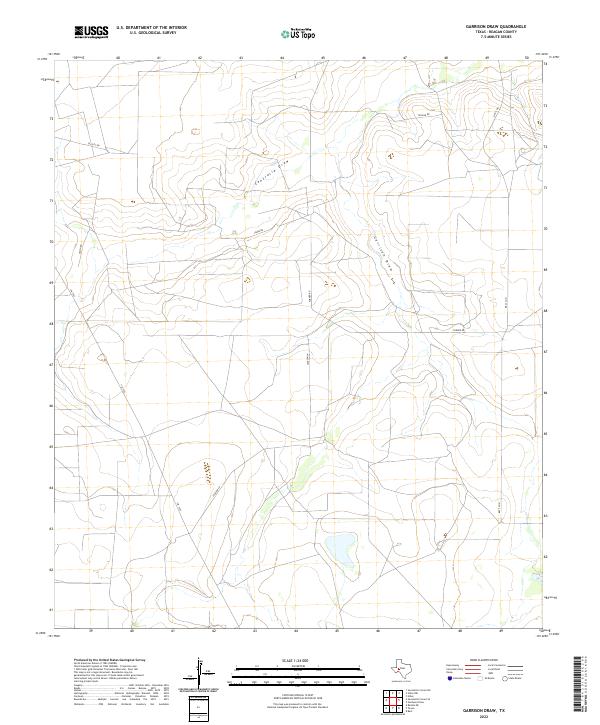
2022 Map of Garrison Draw
USGS Topo · Published 2022About this map
Centralia Draw and Garrison Draw define the drainage patterns of this Reagan County landscape, carving shallow paths through the arid terrain of West Texas. The map illustrates a rural area characterized by a network of ranch and county roads, reflecting a modern land use pattern dominated by large-scale agricultural or oil-related holdings. Long, straight stretches of Fm 1555 and Jackson Ln cross the territory, connecting isolated points of interest across the brushland. Family-named thoroughfares such as Yocham Rd, Elliott Rd, and Dixon Rd suggest the enduring presence of local ranching families and property boundaries in this sparsely populated section of the Permian Basin. This topographical study captures the subtle elevation changes and the importance of ephemeral watercourses in an environment where water and access roads are the primary drivers of human activity.
Find a feature on this map
10 named features on this map. Tap any name to fly to it.
Don’t see what you’re looking for? This feature index may not catch every label — zoom into the map to look around manually.
Map Details
Editions of this 2022 Garrison Draw Map
This is the sole edition of this map. No revisions or reprints were ever made.
Other maps of this area

1928 · Rankin
USGS Topo · 1:125,000

1954 · San Angelo
USGS Topo · 1:250,000

1958 · San Angelo
USGS Topo · 1:250,000

1965 · San Angelo
USGS Topo · 1:250,000

1970 · Sevenmile Corner NE
USGS Topo · 1:24,000

1970 · Stiles NW
USGS Topo · 1:24,000

1970 · Sevenmile Corner SE
USGS Topo · 1:24,000
1970 · Rankin NE
USGS Topo · 1:24,000

1970 · Garrison Draw
USGS Topo · 1:24,000

1970 · Gardener Draw
USGS Topo · 1:24,000