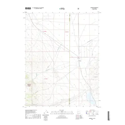
2020 Map of Garrison
USGS Topo · Published 2020About this map
Garrison serves as the primary hub of this high-desert landscape on the border of Utah and Nevada. The settlement is centered around a Po and the Garrison Cem, marking a site of long-standing residence in the Great Basin. To the west, the foothills of the Humboldt National Forest rise toward the mountains, providing critical water sources like Spring Creek Spring and Snake Cr. These drainages flow eastward into the valley, eventually feeding toward Preuss Lake at the southern edge of the quadrangle.
Find a feature on this map
22 named features on this map. Tap any name to fly to it.
Don’t see what you’re looking for? This feature index may not catch every label — zoom into the map to look around manually.
Map Details
Editions of this 2020 Garrison Map
This is the sole edition of this map. No revisions or reprints were ever made.
Other maps of this area

1908 · Fish Springs
USGS Topo · 1:250,000

1910 · Fish Springs
USGS Topo · 1:250,000

1949 · Garrison
USGS Topo · 1:62,500

1951 · Garrison
USGS Topo · 1:62,500

1953 · Richfield
USGS Topo · 1:250,000

1953 · Delta
USGS Topo · 1:250,000

1956 · Lund
USGS Topo · 1:250,000

1956 · Ely
USGS Topo · 1:250,000

1958 · Richfield
USGS Topo · 1:250,000

1958 · Delta
USGS Topo · 1:250,000