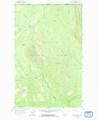
1963 Map of Garver Mountain
USGS Topo · Published 1966About this map
Kootenai National Forest dominates this landscape in the upper northwestern corner of Montana, where the terrain climbs toward high peaks and the international border. This 1963 field-checked survey reveals a remote wilderness defined by the Yaak River and its numerous tributaries, including the West Fork Yaak River and Rampike Creek. Human presence is sparse and focused on early forest management and resource access, marked by the Pete Creek Camp and a Lookout Tower atop Garver Mtn. The map traces a network of primitive routes like the Pack Trail that follow natural contours through Pete Creek Meadows and around the slopes of Mt Obermayer. These features suggest a period when fire watch and backcountry travel were the primary activities in these high-elevation woods before modern forest road expansion.
Find a feature on this map
24 named features on this map. Tap any name to fly to it.
Don’t see what you’re looking for? This feature index may not catch every label — zoom into the map to look around manually.
Map Details
Editions of this 1963 Garver Mountain Map
2 editions found
Other maps of this area

1957 · Kalispell
USGS Topo · 1:250,000

1960 · Kalispell
USGS Topo · 1:250,000

1961 · Kalispell
USGS Topo · 1:250,000

1963 · Yaak
USGS Topo · 1:24,000

1963 · Mount Baldy
USGS Topo · 1:24,000

1963 · Northwest Peak
USGS Topo · 1:24,000

1963 · Garver Mountain
USGS Topo · 1:24,000

1963 · Clark Mountain
USGS Topo · 1:24,000

1963 · Bonnet Top
USGS Topo · 1:24,000

1979 · Yaak River
USGS Topo · 1:100,000