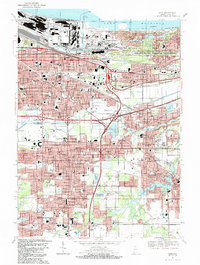
1991 Map of Gary
USGS Topo · Published 1991About this map
The industrial and civic core of Gary is documented here alongside its natural shoreline, stretching from the Grand Calumet River to the Lake Michigan coast. The landscape reveals a dense network of neighborhoods like Tolleston, Miller, and Glen Park, which are connected by major thoroughfares including the Indiana East-West Toll Road and Tri-State Highway. This 1991 revision provides an essential look at the city's complex infrastructure, featuring the sprawling Gary Corporation Boundary and significant institutional landmarks such as the Indiana University Northwest Campus and the Salvatorian Fathers Monastery.
Find a feature on this map
99 named features on this map. Tap any name to fly to it.
Don’t see what you’re looking for? This feature index may not catch every label — zoom into the map to look around manually.
Map Details
Editions of this 1991 Gary Map
2 editions found
Other maps of this area

1900 · Toleston
USGS Topo · 1:62,500

1934 · Porter
USGS Topo · 1:48,000

1940 · Porter
USGS Topo · 1:62,500

1953 · St. John
USGS Topo · 1:24,000

1953 · Palmer
USGS Topo · 1:24,000

1953 · Gary
USGS Topo · 1:24,000

1953 · Crown Point
USGS Topo · 1:24,000
1953 · Whiting
USGS Topo · 1:24,000

1953 · Garyton
USGS Topo · 1:24,000

1953 · Ogden Dunes
USGS Topo · 1:24,000