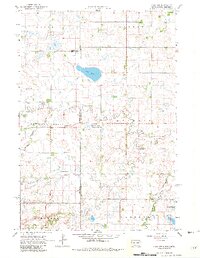
1967 Map of Gary NW
USGS Topo · Published 1982About this map
Salt Lake sits at the center of this prairie landscape, straddling the border between South Dakota and Minnesota during the late 1960s. The region is defined by its watercourses, including Lost Creek, Timber Creek, and Crow Creek, which drain toward the West Branch Lac qui Parle River. Human settlement is sparsely distributed across township sections in Glenwood, Manfred, and Mehurin, anchored by community landmarks such as Zoar Ch and Antelope Valley Ch.
Find a feature on this map
23 named features on this map. Tap any name to fly to it.
Don’t see what you’re looking for? This feature index may not catch every label — zoom into the map to look around manually.
Map Details
Editions of this 1967 Gary NW Map
4 editions found
Other maps of this area

1953 · Bellingham
USGS Topo · 1:62,500

1953 · Milbank
USGS Topo · 1:250,000

1953 · Watertown
USGS Topo · 1:250,000

1958 · Milbank
USGS Topo · 1:250,000

1958 · Watertown
USGS Topo · 1:250,000

1967 · Gary
USGS Topo · 1:24,000

1967 · Gary SE
USGS Topo · 1:24,000

1967 · Gary NW
USGS Topo · 1:24,000
1967 · Mount Wickham
USGS Topo · 1:24,000

1971 · Marietta
USGS Topo · 1:24,000
Featured Places
- Glenwood Township, SD
- Antelope Valley Township, SD
- Lac qui Parle County, MN
- Deuel County, SD
- Grant County, SD