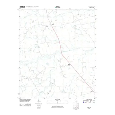
2010 Map of Gary
USGS Topo · Published 2010About this map
Gary and its surrounding hamlets in Panola County are defined by a complex network of bayous and creeks that drain the East Texas landscape. This early 21st-century topography reveals a pattern of dispersed rural settlements, including Pleasant Ridge, Antioch, and Shady Grove, which are linked by winding roads that respect the natural hydrology. Significant local landmarks like Sixmile Hill and Risinger Hill rise above the drainage basins of Murvaul Creek and Sixmile Creek, providing high ground for established communities.
Find a feature on this map
26 named features on this map. Tap any name to fly to it.
Don’t see what you’re looking for? This feature index may not catch every label — zoom into the map to look around manually.
Map Details
Editions of this 2010 Gary Map
This is the sole edition of this map. No revisions or reprints were ever made.
Other maps of this area

1945 · Socagee Bayou
USGS Topo · 1:62,500

1953 · Palestine
USGS Topo · 1:250,000

1956 · Tyler
USGS Topo · 1:250,000

1956 · Deadwood
USGS Topo · 1:62,500

1957 · Palestine
USGS Topo · 1:250,000

1958 · Center
USGS Topo · 1:62,500

1958 · Timpson
USGS Topo · 1:62,500

1958 · Carthage
USGS Topo · 1:62,500
1983 · River Hill
USGS Topo · 1:24,000
1983 · Old Center
USGS Topo · 1:24,000