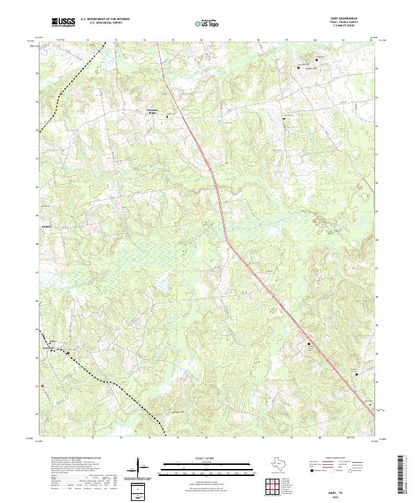
2022 Map of Gary
USGS Topo · Published 2022About this map
Gary City and the surrounding Panola County countryside are defined by a network of small creeks and low-lying wetlands in this modern topographical study. The landscape is characterized by its numerous family and community burial grounds, such as Taylor Cem, Capps Cem, and Woods Cem, which offer significant touchpoints for genealogical research in this part of East Texas. The terrain rises to notable high points at Sixmile Hill and Risinger Hill, while the drainage system of Murvaul Creek and Sixmile Cr shapes the settlement patterns near Pleasant Ridge and Daniels. Highway 59 cuts a straight path through the eastern half of the map, contrasting with the winding paths of Beech Br and Holmes Bayou. The inclusion of small-scale landmarks like Calhoun Lake and local routes like Ball Homestead Rd provides a granular view of the contemporary rural infrastructure.
Find a feature on this map
79 named features on this map. Tap any name to fly to it.
Don’t see what you’re looking for? This feature index may not catch every label — zoom into the map to look around manually.
Map Details
Editions of this 2022 Gary Map
This is the sole edition of this map. No revisions or reprints were ever made.
Other maps of this area

1945 · Socagee Bayou
USGS Topo · 1:62,500

1953 · Palestine
USGS Topo · 1:250,000

1956 · Tyler
USGS Topo · 1:250,000

1956 · Deadwood
USGS Topo · 1:62,500

1957 · Palestine
USGS Topo · 1:250,000

1958 · Center
USGS Topo · 1:62,500

1958 · Timpson
USGS Topo · 1:62,500

1958 · Carthage
USGS Topo · 1:62,500
1983 · River Hill
USGS Topo · 1:24,000
1983 · Old Center
USGS Topo · 1:24,000