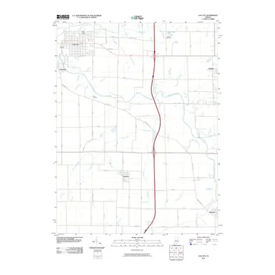
2010 Map of Gas City
USGS Topo · Published 2010About this map
The Mississinewa River winds through the heart of this East Central Indiana landscape, anchoring the historical development of Gas City and Jonesboro. This early 21st-century record reveals a region defined by its water management and agricultural infrastructure, featuring an extensive network of named drainage systems like Galatia Ditch, Fowler Ditch, and Hyer Ditch. These waterways illustrate the modification of the natural prairie for farming, while the presence of Walnut Creek Cemetery, Riverside Cemetery, and Bethel Cemetery provides critical touchpoints for family historians and genealogists. To the north, Sports Lake and the Sports Lake Dam represent recreational development alongside the more traditional rural settlements of Fowlerton and Matthews. The map clearly delineates the convergence of local transit routes such as the Wheeling Pike with modern highway corridors, showcasing the area's evolution from a river-oriented economy to a modern transportation hub.
Find a feature on this map
42 named features on this map. Tap any name to fly to it.
Don’t see what you’re looking for? This feature index may not catch every label — zoom into the map to look around manually.
Map Details
Editions of this 2010 Gas City Map
This is the sole edition of this map. No revisions or reprints were ever made.
Other maps of this area

1953 · Muncie
USGS Topo · 1:250,000

1956 · Muncie
USGS Topo · 1:250,000

1960 · Alexandria
USGS Topo · 1:24,000

1960 · Wheeling
USGS Topo · 1:24,000

1960 · Fairmount
USGS Topo · 1:24,000

1960 · Gas City
USGS Topo · 1:24,000

1960 · Gaston
USGS Topo · 1:24,000

1960 · Hartford City West
USGS Topo · 1:24,000

1961 · Marion
USGS Topo · 1:24,000

1962 · Roll
USGS Topo · 1:24,000