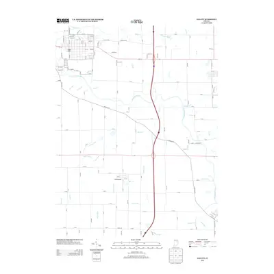
2013 Map of Gas City
USGS Topo · Published 2013About this map
The Mississinewa River winds through this Grant County landscape, defining the topography between the urban grid of Gas City and the smaller settlement of Fowlerton. This 2013 survey illustrates the heavy reliance on engineered water management in the rural sections of the quadrangle, where a dense network of drainage features like Galatia Ditch, Fowler Ditch, and Foulerton Drain support the surrounding agricultural land. To the north, the street layout of Gas City is detailed with numerous residential ways such as Colony Way, Walnut Dr, and Virgil Dr, while the eastern portion of the map remains largely rural, dotted by features like Sports Lake and Ball Run. The mapping of small tributaries such as Ethel Run, Regular Run, and Octain Cr provides a clear view of how the local hydrology connects to the primary river system.
Find a feature on this map
136 named features on this map. Tap any name to fly to it.
Don’t see what you’re looking for? This feature index may not catch every label — zoom into the map to look around manually.
Map Details
Editions of this 2013 Gas City Map
This is the sole edition of this map. No revisions or reprints were ever made.
Other maps of this area

1953 · Muncie
USGS Topo · 1:250,000

1956 · Muncie
USGS Topo · 1:250,000

1960 · Alexandria
USGS Topo · 1:24,000

1960 · Wheeling
USGS Topo · 1:24,000

1960 · Fairmount
USGS Topo · 1:24,000

1960 · Gas City
USGS Topo · 1:24,000

1960 · Gaston
USGS Topo · 1:24,000

1960 · Hartford City West
USGS Topo · 1:24,000

1961 · Marion
USGS Topo · 1:24,000

1962 · Roll
USGS Topo · 1:24,000