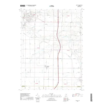
2019 Map of Gas City
USGS Topo · Published 2019About this map
Gas City and Jonesboro dominate the northwest corner of this Grant County landscape, where the Mississinewa River winds through a network of small agricultural communities. The river valley is a central corridor, joined by tributaries such as Shell Run, Ethel Run, and Octagon Cr. The map reveals a highly structured grid of county roads, including historical routes like Muncie Pike and Wheeling Pike, which connect the larger towns to smaller settlements like Fowlerton and Matthews.
Find a feature on this map
104 named features on this map. Tap any name to fly to it.
Don’t see what you’re looking for? This feature index may not catch every label — zoom into the map to look around manually.
Map Details
Editions of this 2019 Gas City Map
This is the sole edition of this map. No revisions or reprints were ever made.
Other maps of this area

1953 · Muncie
USGS Topo · 1:250,000

1956 · Muncie
USGS Topo · 1:250,000

1960 · Alexandria
USGS Topo · 1:24,000

1960 · Wheeling
USGS Topo · 1:24,000

1960 · Fairmount
USGS Topo · 1:24,000

1960 · Gas City
USGS Topo · 1:24,000

1960 · Gaston
USGS Topo · 1:24,000

1960 · Hartford City West
USGS Topo · 1:24,000

1961 · Marion
USGS Topo · 1:24,000

1962 · Roll
USGS Topo · 1:24,000