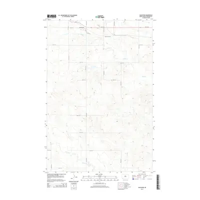
2014 Map of Gascoyne
USGS Topo · Published 2014About this map
Gascoyne occupies the northern edge of this Bowman County landscape, centered at the junction of Us-12 and Main St. This pocket of the Great Plains is defined by a grid of rural section roads, including Knife River Rd and 90th St SW, which weave through a terrain carved by meandering waterways. The industrial character of the region is grounded by the American Coalloid facility, situated just south of the primary settlement. The natural hydrology is dominated by the sprawling reaches of Buffalo Creek in the north and the winding path of Lightning Creek to the south. This survey illustrates the relationship between a small agricultural and industrial outpost and the expansive drainage systems of the North Dakota prairie, where local infrastructure like E Schuett Ave connects the homesteads to the primary regional thoroughfare.
Find a feature on this map
22 named features on this map. Tap any name to fly to it.
Don’t see what you’re looking for? This feature index may not catch every label — zoom into the map to look around manually.
Map Details
Editions of this 2014 Gascoyne Map
This is the sole edition of this map. No revisions or reprints were ever made.
Other maps of this area

1935 · Reva
USGS Topo · 1:125,000

1953 · Dickinson
USGS Topo · 1:250,000

1954 · Lemmon
USGS Topo · 1:250,000

1957 · Dickinson
USGS Topo · 1:250,000

1957 · Lemmon
USGS Topo · 1:250,000

1968 · Haley
USGS Topo · 1:24,000

1968 · Bowman-Haley Dam
USGS Topo · 1:24,000

1969 · Scranton
USGS Topo · 1:24,000

1969 · Gascoyne
USGS Topo · 1:24,000

1969 · Reeder
USGS Topo · 1:24,000