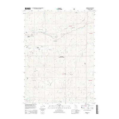
2015 Map of Gasquet
USGS Topo · Published 2015About this map
The confluence of the North Fork Smith River and Middle Fork Smith River serves as the central hub for this Del Norte County region, where the community of Gasquet sits at the junction of mountain roads and waterways. This rugged section of the Six Rivers National Forest is defined by its series of river terraces or "flats," such as Pappas Flat, French Flat, and Humboldt Flat, which provided rare level ground for settlement and airstrips like Ward Field. The legacy of 19th-century transit and resource extraction is evident in the path of the Old Gasquet Toll Rd and the Tyson Mine Rd, which wind through the steep drainage basins of Craigs Creek and Coon Creek. Local heritage is anchored at the Gasquet Cemetery and the small enclave at Adams Station, while Darlingtonia reflects the unique botanical and geological character of the Klamath Mountains landscape.
Find a feature on this map
38 named features on this map. Tap any name to fly to it.
Don’t see what you’re looking for? This feature index may not catch every label — zoom into the map to look around manually.
Map Details
Editions of this 2015 Gasquet Map
This is the sole edition of this map. No revisions or reprints were ever made.
Other maps of this area

1922 · Preston Peak
USGS Topo · 1:125,000

1929 · Crescent City
USGS Topo · 1:125,000

1945 · Ship Mountain
USGS Topo · 1:62,500

1945 · Gasquet
USGS Topo · 1:62,500

1945 · Point St. George
USGS Topo · 1:62,500

1945 · Requa
USGS Topo · 1:62,500

1948 · Weed
USGS Topo · 1:250,000

1949 · Eureka
USGS Topo · 1:250,000

1950 · Weed
USGS Topo · 1:250,000

1951 · Gasquet
USGS Topo · 1:62,500