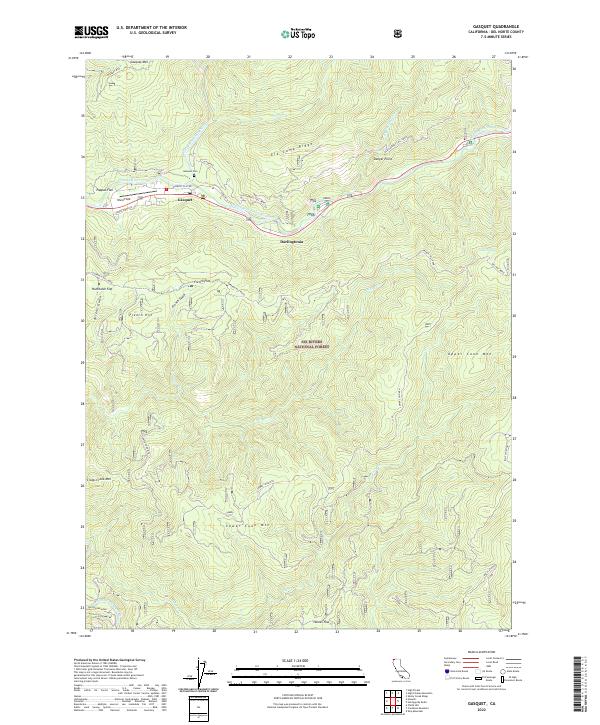
2022 Map of Gasquet
USGS Topo · Published 2022About this map
The Middle Fork Smith River and North Fork Smith River converge near the mountain settlement of Gasquet in this 2022 survey of Del Norte County. The landscape is defined by the steep elevation gains of Gasquet Mtn and Elk Camp Ridge, which are protected within the Six Rivers National Forest. This modern topo map documents the transition from early transit routes to contemporary infrastructure, notably preserving the alignment of the Old Gasquet Toll Road as it winds along the river valley toward Danger Point. Local history is centered on small enclaves like Darlingtonia and the Gasquet Cem, while recreational and municipal spaces such as Ward Field serve the river community. The map provides clear detail on named flats and gulches, including Humboldt Flat and French Gulch, which speak to the area's legacy of timber and prospecting.
Find a feature on this map
38 named features on this map. Tap any name to fly to it.
Don’t see what you’re looking for? This feature index may not catch every label — zoom into the map to look around manually.
Map Details
Editions of this 2022 Gasquet Map
This is the sole edition of this map. No revisions or reprints were ever made.
Other maps of this area

1922 · Preston Peak
USGS Topo · 1:125,000

1929 · Crescent City
USGS Topo · 1:125,000

1945 · Ship Mountain
USGS Topo · 1:62,500

1945 · Gasquet
USGS Topo · 1:62,500

1945 · Point St. George
USGS Topo · 1:62,500

1945 · Requa
USGS Topo · 1:62,500

1948 · Weed
USGS Topo · 1:250,000

1949 · Eureka
USGS Topo · 1:250,000

1950 · Weed
USGS Topo · 1:250,000

1951 · Gasquet
USGS Topo · 1:62,500