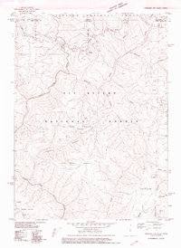
1975 Map of Gasquet NW
USGS Topo · Published 1975About this map
The Six Rivers National Forest straddles the border of Oregon and California, centered on the rugged drainage basins of the Smith River and North Fork Smith River. This mid-1970s experimental edition shows a landscape defined by industrial extraction and high-elevation terrain. Miners and prospectors were active across these ridges, leaving behind named sites such as the Cleopatra Mine, Judy Mine, and Browns Mine. Near the eastern boundary, Big Boy Mine sits adjacent to the Curry Co Del Norte Co line. Movement through this steep country relied on historical routes like the Wimer Road, while the numerous creeks—including Diamond Creek, Eightmile Creek, and Twelvemile Cr—carve through formations such as Peridotite Canyon. The prevalence of open pit mines and scattered prospects across High Plateau Mountain and Pine Flat Mountain reflects the region's long-standing reliance on its mineral resources.
Find a feature on this map
27 named features on this map. Tap any name to fly to it.
Don’t see what you’re looking for? This feature index may not catch every label — zoom into the map to look around manually.
Map Details
Editions of this 1975 Gasquet NW Map
This is the sole edition of this map. No revisions or reprints were ever made.
Other maps of this area

1917 · Kerby
USGS Topo · 1:125,000

1918 · Kerby
USGS Topo · 1:125,000

1922 · Preston Peak
USGS Topo · 1:125,000

1929 · Crescent City
USGS Topo · 1:125,000

1945 · Kerby
USGS Topo · 1:125,000

1945 · Gasquet
USGS Topo · 1:62,500

1945 · Point St. George
USGS Topo · 1:62,500

1948 · Weed
USGS Topo · 1:250,000

1949 · Eureka
USGS Topo · 1:250,000

1950 · Weed
USGS Topo · 1:250,000