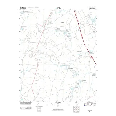
2011 Map of Gaston
USGS Topo · Published 2011About this map
The town of Gaston and the neighboring community of Enos anchor this early 21st-century landscape in Lexington County, defined by a complex network of managed water bodies and rural industry. The terrain is marked by significant topographical features like Sand Mountain, while the hydrology of the region is heavily modified by numerous dams and reservoirs. Notable among these are Huckabaas Millpond and Moores Millpond along the N-Fork Sandy Run, as well as industrial features like the Carolina Eastman Waste Pond and the State Record Pond. The map reveals the infrastructure of the era, from the Lexington County Airport to the recreational grounds of Camp Barstow. Many labels designate specific named ponds such as Acres Pond and Dixon Pond, which, along with family-named landmarks like Boozer Lower Pond, provide specific touchpoints for local history and genealogy research.
Find a feature on this map
148 named features on this map. Tap any name to fly to it.
Don’t see what you’re looking for? This feature index may not catch every label — zoom into the map to look around manually.
Map Details
Editions of this 2011 Gaston Map
This is the sole edition of this map. No revisions or reprints were ever made.
Other maps of this area

1944 · Edmund
USGS Topo · 1:62,500

1946 · Woodford
USGS Topo · 1:62,500

1946 · St. Matthews
USGS Topo · 1:62,500

1948 · Hopkins
USGS Topo · 1:62,500

1953 · Saylors Lake
USGS Topo · 1:24,000

1953 · Fort Jackson South
USGS Topo · 1:24,000

1954 · Augusta
USGS Topo · 1:250,000

1957 · Augusta
USGS Topo · 1:250,000

1958 · Augusta
USGS Topo · 1:250,000

1961 · Augusta
USGS Topo · 1:250,000