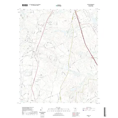
2020 Map of Gaston
USGS Topo · Published 2020About this map
Gaston and Swansea anchor this landscape along the border of Lexington and Calhoun Counties, where the terrain is defined by a dense network of small water bodies and seasonal creeks. The presence of Moores Millpond and State Record Pond reflects a legacy of water management and local industry, while the Gaston Airport serves as a modern landmark. North of the town center, Sand Mtn rises above the drainage basins of Savany Hunt Cr and N Fork Sandy Run. The area's settlement pattern follows historical routes like Old Wire Rd and Old State Rd, revealing a transition from agricultural roots to modern rural-residential growth. Numerous private landings and small impoundments such as Lackland Pond and Sulton Pond dot the southern reaches, highlighting the region's reliance on these managed waterways for drainage and recreation.
Find a feature on this map
138 named features on this map. Tap any name to fly to it.
Don’t see what you’re looking for? This feature index may not catch every label — zoom into the map to look around manually.
Map Details
Editions of this 2020 Gaston Map
This is the sole edition of this map. No revisions or reprints were ever made.
Other maps of this area

1944 · Edmund
USGS Topo · 1:62,500

1946 · Woodford
USGS Topo · 1:62,500

1946 · St. Matthews
USGS Topo · 1:62,500

1948 · Hopkins
USGS Topo · 1:62,500

1953 · Saylors Lake
USGS Topo · 1:24,000

1953 · Fort Jackson South
USGS Topo · 1:24,000

1954 · Augusta
USGS Topo · 1:250,000

1957 · Augusta
USGS Topo · 1:250,000

1958 · Augusta
USGS Topo · 1:250,000

1961 · Augusta
USGS Topo · 1:250,000