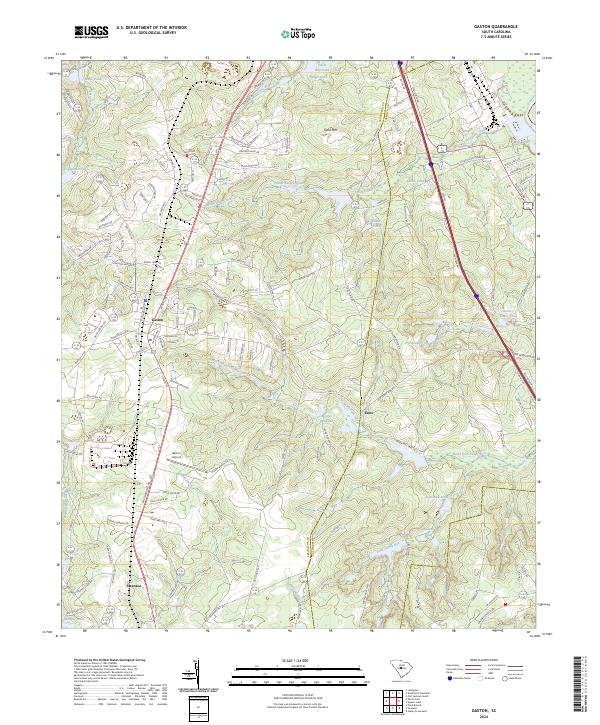
2024 Map of Gaston
USGS Topo · Published 2024About this map
Gaston and Swansea anchor this portion of the South Carolina Midlands, defined by a landscape of small farm ponds and drainage systems flowing toward the Congaree River basin. The terrain rises to Sand Mtn, overlooking a network of named water bodies including Moores Millpond, Lackland Pond, and State-Record Pond. Transportation patterns here reflect both modern growth and historical transit, with the prominent Southbound Rd and Old State RD cutting through the region alongside the more evocative Stagecoach Rd.
Find a feature on this map
37 named features on this map. Tap any name to fly to it.
Don’t see what you’re looking for? This feature index may not catch every label — zoom into the map to look around manually.
Map Details
Editions of this 2024 Gaston Map
This is the sole edition of this map. No revisions or reprints were ever made.
Other maps of this area

1944 · Edmund
USGS Topo · 1:62,500

1946 · Woodford
USGS Topo · 1:62,500

1946 · St. Matthews
USGS Topo · 1:62,500

1948 · Hopkins
USGS Topo · 1:62,500

1953 · Saylors Lake
USGS Topo · 1:24,000

1953 · Fort Jackson South
USGS Topo · 1:24,000

1954 · Augusta
USGS Topo · 1:250,000

1957 · Augusta
USGS Topo · 1:250,000

1958 · Augusta
USGS Topo · 1:250,000

1961 · Augusta
USGS Topo · 1:250,000