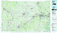
1986 Map of Gastonia
USGS Topo · Published 1986About this map
Kings Mountain National Military Park and Cowpens National Battlefield anchor this mid-1980s landscape, marking pivotal Revolutionary War sites along the border of the Carolinas. The map illustrates a region defined by its manufacturing hubs and textile heritage, including Gastonia, Shelby, and Gaffney. Industrial transport routes are well-established, with the Seaboard System Railroad and Southern Railway crisscrossing the terrain to serve settlements like Cherryville, Lincolnton, and Kings Mountain.
Find a feature on this map
247 named features on this map. Tap any name to fly to it.
Don’t see what you’re looking for? This feature index may not catch every label — zoom into the map to look around manually.
Map Details
Editions of this 1986 Gastonia Map
This is the sole edition of this map. No revisions or reprints were ever made.
Other maps of this area

1893 · Statesville
USGS Topo · 1:125,000

1895 · Hickory
USGS Topo · 1:125,000

1900 · Mount Mitchell
USGS Topo · 1:125,000

1902 · Mount Mitchell
USGS Topo · 1:125,000

1905 · Charlotte
USGS Topo · 1:48,000

1905 · Morganton
USGS Topo · 1:125,000

1906 · Kings Mountain
USGS Topo · 1:62,500

1907 · Sharon
USGS Topo · 1:62,500

1907 · Saluda
USGS Topo · 1:125,000

1907 · Charlotte
USGS Topo · 1:62,500