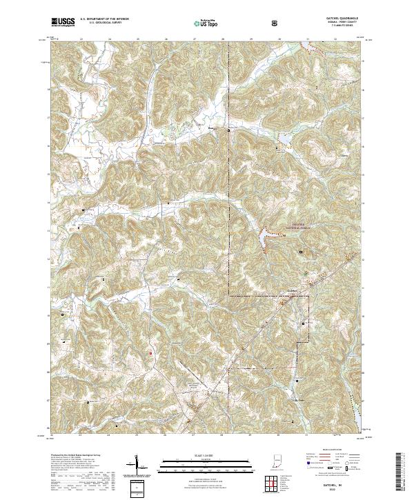
2022 Map of Gatchel
USGS Topo · Published 2022About this map
The hills and hollows of Perry County are depicted here in detail, centered on the community of Gatchel and the surrounding reaches of the Hoosier National Forest. The landscape is defined by its ridge-and-hollow topography, including Saint Joe Ridge and Theis Ridge, which separate various tributaries of the Middle Fork Anderson River. Local genealogy is well-served by numerous burial sites scattered across the township lines, such as Saint Johns Cem near the settlement of Terry and the Slaughter Cem located along Theis Cr. The southern portion of the map transitions toward more developed infrastructure, notably featuring the Perry County Municipal Airport situated near Lilly Dale. A network of rural routes, such as Sulphur Valley Rd and Aztec Rd, connects the isolated farmsteads and small settlements of Ranger and Gatchel, illustrating the persistent rural character of this southern Indiana region.
Find a feature on this map
134 named features on this map. Tap any name to fly to it.
Don’t see what you’re looking for? This feature index may not catch every label — zoom into the map to look around manually.
Map Details
Editions of this 2022 Gatchel Map
This is the sole edition of this map. No revisions or reprints were ever made.
Other maps of this area

1900 · St Meinrad
USGS Topo · 1:62,500

1903 · St. Meinrad
USGS Topo · 1:62,500

1903 · Tell City
USGS Topo · 1:62,500

1934 · Cannelton
USGS Topo · 1:62,500

1949 · Cannelton
USGS Topo · 1:24,000

1953 · Cannelton
USGS Topo · 1:24,000

1953 · Tell City
USGS Topo · 1:24,000
1953 · Rome
USGS Topo · 1:24,000

1954 · Evansville
USGS Topo · 1:250,000

1954 · Derby
USGS Topo · 1:24,000