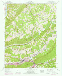
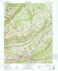
1938 Map of Gate City
USGS Topo · Published 1978About this map
The Southern railroad corridor anchors the southern edge of this landscape, cutting through Moccasin Gap to connect the settlements of Gate City, Marcem, and Nottingham. This gap provides a natural conduit through Moccasin Valley and Poor Valley Ridge, where the terrain transitions from the broader agricultural valley floor to the high point at Big Knob. The map reveals a dense network of local institutions essential to early 20th-century rural life, including the Addington Store and various family-named milling sites like Williams Mill and Carrico Mill.
Find a feature on this map
75 named features on this map. Tap any name to fly to it.
Don’t see what you’re looking for? This feature index may not catch every label — zoom into the map to look around manually.
Map Details
Editions of this 1938 Gate City Map
5 editions found
Other maps of this area

1894 · Estillville
USGS Topo · 1:125,000

1897 · Bristol
USGS Topo · 1:125,000

1902 · Bristol
USGS Topo · 1:125,000

1920 · Wise
USGS Topo · 1:48,000

1920 · Coeburn
USGS Topo · 1:48,000

1921 · Wise
USGS Topo · 1:62,500

1935 · Hilton
USGS Topo · 1:24,000

1935 · Moggasin
USGS Topo · 1:48,000

1935 · East Stone Gap
USGS Topo · 1:24,000

1935 · Kingsport
USGS Topo · 1:24,000