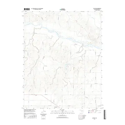
2016 Map of Gate NW
USGS Topo · Published 2016About this map
Knowles sits near the southern edge of this Beaver County landscape, where the flat plains of the Oklahoma Panhandle are deeply incised by the drainage systems of the Cimarron River. The river itself creates a broad, braided path across the northern half of the map, fed by numerous seasonal waterways including Taintor Creek, Cottonwood Creek, and Kidds Cr. This environment is defined by a dense network of named hollows, such as Hollow N1556 and Hollow E0025, which illustrate the complex erosion patterns common in this semi-arid region.
Find a feature on this map
49 named features on this map. Tap any name to fly to it.
Don’t see what you’re looking for? This feature index may not catch every label — zoom into the map to look around manually.
Map Details
Editions of this 2016 Gate NW Map
This is the sole edition of this map. No revisions or reprints were ever made.
Other maps of this area

1892 · Meade
USGS Topo · 1:125,000

1954 · Perryton
USGS Topo · 1:250,000

1955 · Dodge City
USGS Topo · 1:250,000

1958 · Perryton
USGS Topo · 1:250,000

1958 · Dodge City
USGS Topo · 1:250,000

1959 · Dodge City
USGS Topo · 1:250,000

1962 · Irish Flats SE
USGS Topo · 1:24,000

1970 · Knowles
USGS Topo · 1:24,000

1970 · Gate
USGS Topo · 1:24,000
1970 · Gate NE
USGS Topo · 1:24,000